Earth System Data Cube (ESDC) v3.0.1#
How to open this dataset in DeepESDL JupyterLab#
from xcube.core.store import new_data_store
store = new_data_store("s3", root="deep-esdl-public", storage_options=dict(anon=True))
ds = store.open_data('esdc-8d-0.25deg-1x720x1440-3.0.1.zarr')
Bounding box map#
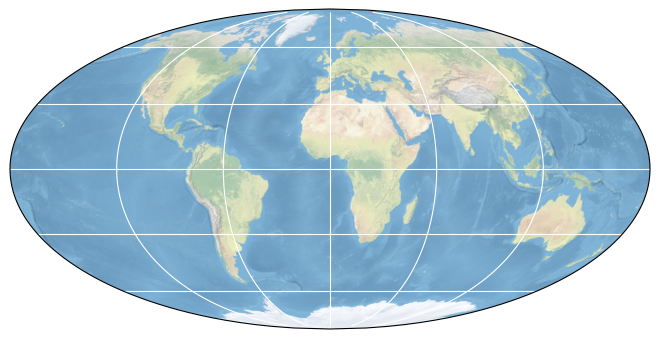
Map tiles and data from OpenStreetMap, under the ODbL.
Basic information#
| Parameter | Value |
|---|---|
| Bounding box longitude (°) | -180.0 to 180.0 |
| Bounding box latitude (°) | -90.0 to 90.0 |
| Time range | 1979-01-05 to 2021-12-31 |
| Publisher | DeepESDL Team |
Click here for full dataset metadata.
Variable list#
Click on a variable name to jump to the variable’s full metadata.
| Variable | Long name | Units |
|---|---|---|
| aerosol_optical_thickness_550 | Aerosol Optical Thickness at 550 nm | 1 |
| air_temperature_2m | Mean Air Temperature at 2 m | °C |
| bare_soil_evaporation | Bare Soil Evaporation | mm d^-1 |
| burnt_area | Monthly Burnt Area | hectares |
| cot | Cloud Optical Thickness | 1 |
| cth | Cloud Top Height | km |
| ctt | Cloud Top Temperature | K |
| evaporation | Actual Evaporation | mm d^-1 |
| evaporation_era5 | Evaporation | mm d^-1 |
| evaporative_stress | Evaporative Stress | 1 |
| gross_primary_productivity | Gross Primary Productivity | g C m^-2 d^-1 |
| interception_loss | Interception Loss | mm d^-1 |
| kndvi | Kernel Normalized Difference Vegetation Index | 1 |
| latent_energy | Latent Energy | MJ m^-2 d^-1 |
| max_air_temperature_2m | Maximum Air Temperature at 2 m | °C |
| min_air_temperature_2m | Minimum Air Temperature at 2 m | °C |
| nbar_blue | Nadir BRDF Adjusted Reflectance of Band 3 (blue) | 1 |
| nbar_green | Nadir BRDF Adjusted Reflectance of Band 4 (green) | 1 |
| nbar_nir | Nadir BRDF Adjusted Reflectance of Band 2 (NIR) | 1 |
| nbar_red | Nadir BRDF Adjusted Reflectance of Band 1 (red) | 1 |
| nbar_swir1 | Nadir BRDF Adjusted Reflectance of Band 5 (SWIR1) | 1 |
| nbar_swir2 | Nadir BRDF Adjusted Reflectance of Band 6 (SWIR2) | 1 |
| nbar_swir3 | Nadir BRDF Adjusted Reflectance of Band 7 (SWIR3) | 1 |
| ndvi | Normalized Difference Vegetation Index | 1 |
| net_ecosystem_exchange | Net Ecosystem Exchange | g C m^-2 d^-1 |
| net_radiation | Net Radiation | MJ m^-2 d^-1 |
| nirv | Near Infrared Reflectance of Vegetation | 1 |
| open_water_evaporation | Open-water Evaporation | mm d^-1 |
| potential_evaporation | Potential Evaporation | mm d^-1 |
| precipitation_era5 | Total Precipitation | mm d^-1 |
| radiation_era5 | Surface Net Solar Radiation | J m^-2 |
| root_moisture | Root-zone Soil Moisture | mm d^-1 |
| sensible_heat | Sensible Heat | MJ m^-2 d^-1 |
| sif_gome2_jj | Downscaled Daily Corrected Sun-Induced Chlorophyll Fluorescence at 740 nm | m W m^-2 sr^-1 nm^-1 |
| sif_gome2_pk | Downscaled Daily Corrected Sun-Induced Chlorophyll Fluorescence at 740 nm | m W m^-2 sr^-1 nm^-1 |
| sif_gosif | Sun-Induced Chlorophyll Fluorescence at 757 nm | W m^-2 sr^-1 um^-1 |
| sif_rtsif | Sun-Induced Chlorophyll Fluorescence at 740 nm | m W m^-2 sr^-1 um^-1 |
| sm | Volumetric Soil Moisture | m^3 m^-3 |
| snow_sublimation | Snow Sublimation | mm d^-1 |
| surface_moisture | Surface Soil Moisture | mm d^-1 |
| terrestrial_ecosystem_respiration | Terrestrial Ecosystem Respiration | g C m^-2 d^-1 |
| transpiration | Transpiration | mm d^-1 |
Full variable metadata#
aerosol_optical_thickness_550#
| Field | Value |
|---|---|
| acknowledgment | ESA Aerosol Climate Change Initiative (Aerosol_cci) |
| date_modified | 2022-10-13 03:15:18.312024 |
| description | ESA Aerosol Climate Change Initiative (Aerosol_cci): Level 3 aerosol products from AATSR (ensemble product), Version 2.6 |
| geospatial_lat_max | 89.875 |
| geospatial_lat_min | -89.875 |
| geospatial_lat_resolution | 0.25 |
| geospatial_lon_max | 179.875 |
| geospatial_lon_min | -179.875 |
| geospatial_lon_resolution | 0.25 |
| license | Terms and conditions of the DeepESDL data distribution |
| long_name | Aerosol Optical Thickness at 550 nm |
| original_add_offset | 0.0 |
| original_name | AOD550_mean |
| original_scale_factor | 1.0 |
| processing_steps | Loading data using the cciodp xcube data store, Resampling by 8-day mean, Upsampling to 0.25 degrees using nearest neighbor |
| project | DeepESDL |
| references | https://doi.org/10.5194/amt-6-1919-2013 |
| reported_day | 5.0 |
| source | https://catalogue.ceda.ac.uk/uuid/c183044b88734442b6d37f5c4f6b0092 |
| standard_name | atmosphere_optical_thickness_due_to_ambient_aerosol |
| temporal_resolution | 8D |
| time_coverage_end | 2012-04-10T00:00:00.000000000 |
| time_coverage_start | 2002-05-21T00:00:00.000000000 |
| time_period | 8D |
| units | 1 |
air_temperature_2m#
| Field | Value |
|---|---|
| acknowledgment | ERA5 hourly data on single levels from 1959 to present |
| date_modified | 2022-11-04 15:41:36.233472 |
| description | ERA5 Reanalysis Products |
| geospatial_lat_max | 89.875 |
| geospatial_lat_min | -89.875 |
| geospatial_lat_resolution | 0.25 |
| geospatial_lon_max | 179.875 |
| geospatial_lon_min | -179.875 |
| geospatial_lon_resolution | 0.25 |
| license | Terms and conditions of the DeepESDL data distribution |
| long_name | Mean Air Temperature at 2 m |
| original_add_offset | 0.0 |
| original_name | t2m |
| original_scale_factor | 1.0 |
| processing_steps | Merging nc files, Resampling by daily mean, Converting to °C from K, Resampling by 8-day mean, Resampling to 0.25 degrees using bilinear interpolation |
| project | DeepESDL |
| references | https://confluence.ecmwf.int/display/CKB/ERA5%3A+data+documentation |
| reported_day | 5.0 |
| source | https://cds.climate.copernicus.eu/cdsapp#!/dataset/reanalysis-era5-single-levels |
| standard_name | mean_air_temperature_2m |
| temporal_resolution | 8D |
| time_coverage_end | 2021-12-27T00:00:00.000000000 |
| time_coverage_start | 1979-01-01T00:00:00.000000000 |
| time_period | 8D |
| units | °C |
bare_soil_evaporation#
| Field | Value |
|---|---|
| acknowledgment | https://www.gleam.eu/ |
| date_modified | 2022-10-11 16:47:36.234042 |
| description | Global Land Evaporation Amsterdam Model (GLEAM) v3.6a |
| geospatial_lat_max | 89.875 |
| geospatial_lat_min | -89.875 |
| geospatial_lat_resolution | -0.25 |
| geospatial_lon_max | 179.875 |
| geospatial_lon_min | -179.875 |
| geospatial_lon_resolution | 0.25 |
| license | Terms and conditions of the DeepESDL data distribution |
| long_name | Bare Soil Evaporation |
| original_add_offset | 0.0 |
| original_name | Eb |
| original_scale_factor | 1.0 |
| processing_steps | Merging nc files, resampling by 8-day mean |
| project | DeepESDL |
| references | https://doi.org/10.5194/gmd-10-1903-2017, https://doi.org/10.5194/hess-15-453-2011 |
| reported_day | 5.0 |
| source | GLEAM v3.6a, https://www.gleam.eu/ |
| standard_name | bare_soil_evaporation |
| temporal_resolution | 8D |
| time_coverage_end | 2021-12-31T00:00:00.000000000 |
| time_coverage_start | 1980-01-05T00:00:00.000000000 |
| time_period | 8D |
| units | mm d^-1 |
burnt_area#
| Field | Value |
|---|---|
| acknowledgment | https://www.globalfiredata.org/ |
| date_modified | 2022-10-13 14:55:35.002779 |
| description | Global Fire Emissions Database (GFED) 4 Monthly Burnt Area |
| geospatial_lat_max | 89.875 |
| geospatial_lat_min | -89.875 |
| geospatial_lat_resolution | -0.25 |
| geospatial_lon_max | 179.875 |
| geospatial_lon_min | -179.875 |
| geospatial_lon_resolution | 0.25 |
| license | Terms and conditions of the DeepESDL data distribution |
| long_name | Monthly Burnt Area |
| original_add_offset | 0.0 |
| original_name | burnt_area |
| original_scale_factor | 0.01 |
| processing_steps | Merging hdf files, Resampling by 8-day nearest neighbor |
| project | DeepESDL |
| references | https://doi.org/10.1002/jgrg.20042 |
| reported_day | 5.0 |
| source | https://www.globalfiredata.org/ |
| standard_name | burnt_area |
| temporal_resolution | 8D |
| time_coverage_end | 2016-12-30T00:00:00.000000000 |
| time_coverage_start | 1995-06-06T00:00:00.000000000 |
| time_period | 8D |
| units | hectares |
cot#
| Field | Value |
|---|---|
| acknowledgment | ESA Cloud Climate Change Initiative (Cloud_cci) |
| date_modified | 2022-11-04 13:33:18.450458 |
| description | ESA Cloud Climate Change Initiative (Cloud_cci): MODIS-TERRA monthly gridded cloud properties, version 2.0 |
| geospatial_lat_max | 89.875 |
| geospatial_lat_min | -89.875 |
| geospatial_lat_resolution | 0.25 |
| geospatial_lon_max | 179.875 |
| geospatial_lon_min | -179.875 |
| geospatial_lon_resolution | 0.25 |
| license | Terms and conditions of the DeepESDL data distribution |
| long_name | Cloud Optical Thickness |
| original_add_offset | 0.0 |
| original_name | cot |
| original_scale_factor | 1.0 |
| processing_steps | Loading data using the cciodp xcube data store, Resampling by 8-day nearest neighbor, Upsampling to 0.25 degrees using nearest neighbor |
| project | DeepESDL |
| references | https://public.satproj.klima.dwd.de/data/ESA_Cloud_CCI/CLD_PRODUCTS/v2.0/DOIs/DOI_ESA_Cloud_cci_MODIS-Terra_v2.0_landingpage.html, https://dap.ceda.ac.uk/neodc/esacci/cloud/docs/DataSet_Desc_ESA_Cloud_cci_CC4CL_1.5.pdf |
| reported_day | 5.0 |
| source | https://catalogue.ceda.ac.uk/uuid/f1ab07b5292f4813bd3090b51d270aa8 |
| standard_name | atmosphere_optical_thickness_due_to_cloud |
| temporal_resolution | 8D |
| time_coverage_end | 2014-12-15T00:00:00.000000000 |
| time_coverage_start | 2000-02-22T00:00:00.000000000 |
| time_period | 8D |
| units | 1 |
cth#
| Field | Value |
|---|---|
| acknowledgment | ESA Cloud Climate Change Initiative (Cloud_cci) |
| date_modified | 2022-11-04 13:33:18.450458 |
| description | ESA Cloud Climate Change Initiative (Cloud_cci): MODIS-TERRA monthly gridded cloud properties, version 2.0 |
| geospatial_lat_max | 89.875 |
| geospatial_lat_min | -89.875 |
| geospatial_lat_resolution | 0.25 |
| geospatial_lon_max | 179.875 |
| geospatial_lon_min | -179.875 |
| geospatial_lon_resolution | 0.25 |
| license | Terms and conditions of the DeepESDL data distribution |
| long_name | Cloud Top Height |
| original_add_offset | 0.0 |
| original_name | cth |
| original_scale_factor | 1.0 |
| processing_steps | Loading data using the cciodp xcube data store, Resampling by 8-day nearest neighbor, Upsampling to 0.25 degrees using nearest neighbor |
| project | DeepESDL |
| references | https://public.satproj.klima.dwd.de/data/ESA_Cloud_CCI/CLD_PRODUCTS/v2.0/DOIs/DOI_ESA_Cloud_cci_MODIS-Terra_v2.0_landingpage.html, https://dap.ceda.ac.uk/neodc/esacci/cloud/docs/DataSet_Desc_ESA_Cloud_cci_CC4CL_1.5.pdf |
| reported_day | 5.0 |
| source | https://catalogue.ceda.ac.uk/uuid/f1ab07b5292f4813bd3090b51d270aa8 |
| standard_name | cloud_top_altitude |
| temporal_resolution | 8D |
| time_coverage_end | 2014-12-15T00:00:00.000000000 |
| time_coverage_start | 2000-02-22T00:00:00.000000000 |
| time_period | 8D |
| units | km |
ctt#
| Field | Value |
|---|---|
| acknowledgment | ESA Cloud Climate Change Initiative (Cloud_cci) |
| date_modified | 2022-11-04 13:33:18.450458 |
| description | ESA Cloud Climate Change Initiative (Cloud_cci): MODIS-TERRA monthly gridded cloud properties, version 2.0 |
| geospatial_lat_max | 89.875 |
| geospatial_lat_min | -89.875 |
| geospatial_lat_resolution | 0.25 |
| geospatial_lon_max | 179.875 |
| geospatial_lon_min | -179.875 |
| geospatial_lon_resolution | 0.25 |
| license | Terms and conditions of the DeepESDL data distribution |
| long_name | Cloud Top Temperature |
| original_add_offset | 0.0 |
| original_name | ctt |
| original_scale_factor | 1.0 |
| processing_steps | Loading data using the cciodp xcube data store, Resampling by 8-day nearest neighbor, Upsampling to 0.25 degrees using nearest neighbor |
| project | DeepESDL |
| references | https://public.satproj.klima.dwd.de/data/ESA_Cloud_CCI/CLD_PRODUCTS/v2.0/DOIs/DOI_ESA_Cloud_cci_MODIS-Terra_v2.0_landingpage.html, https://dap.ceda.ac.uk/neodc/esacci/cloud/docs/DataSet_Desc_ESA_Cloud_cci_CC4CL_1.5.pdf |
| reported_day | 5.0 |
| source | https://catalogue.ceda.ac.uk/uuid/f1ab07b5292f4813bd3090b51d270aa8 |
| standard_name | air_temperature_at_cloud_top |
| temporal_resolution | 8D |
| time_coverage_end | 2014-12-15T00:00:00.000000000 |
| time_coverage_start | 2000-02-22T00:00:00.000000000 |
| time_period | 8D |
| units | K |
evaporation#
| Field | Value |
|---|---|
| acknowledgment | https://www.gleam.eu/ |
| date_modified | 2022-10-11 16:47:36.234042 |
| description | Global Land Evaporation Amsterdam Model (GLEAM) v3.6a |
| geospatial_lat_max | 89.875 |
| geospatial_lat_min | -89.875 |
| geospatial_lat_resolution | -0.25 |
| geospatial_lon_max | 179.875 |
| geospatial_lon_min | -179.875 |
| geospatial_lon_resolution | 0.25 |
| license | Terms and conditions of the DeepESDL data distribution |
| long_name | Actual Evaporation |
| original_add_offset | 0.0 |
| original_name | E |
| original_scale_factor | 1.0 |
| processing_steps | Merging nc files, resampling by 8-day mean |
| project | DeepESDL |
| references | https://doi.org/10.5194/gmd-10-1903-2017, https://doi.org/10.5194/hess-15-453-2011 |
| reported_day | 5.0 |
| source | GLEAM v3.6a, https://www.gleam.eu/ |
| standard_name | actual_evaporation |
| temporal_resolution | 8D |
| time_coverage_end | 2021-12-31T00:00:00.000000000 |
| time_coverage_start | 1980-01-05T00:00:00.000000000 |
| time_period | 8D |
| units | mm d^-1 |
evaporation_era5#
| Field | Value |
|---|---|
| acknowledgment | ERA5 hourly data on single levels from 1959 to present |
| date_modified | 2022-11-04 15:41:36.233472 |
| description | ERA5 Reanalysis Products |
| geospatial_lat_max | 89.875 |
| geospatial_lat_min | -89.875 |
| geospatial_lat_resolution | 0.25 |
| geospatial_lon_max | 179.875 |
| geospatial_lon_min | -179.875 |
| geospatial_lon_resolution | 0.25 |
| license | Terms and conditions of the DeepESDL data distribution |
| long_name | Evaporation |
| original_add_offset | 0.0 |
| original_name | e |
| original_scale_factor | 1.0 |
| processing_steps | Merging nc files, Resampling by daily sum, Converting to mm from m, Resampling by 8-day mean, Resampling to 0.25 degrees using bilinear interpolation |
| project | DeepESDL |
| references | https://confluence.ecmwf.int/display/CKB/ERA5%3A+data+documentation |
| reported_day | 5.0 |
| source | https://cds.climate.copernicus.eu/cdsapp#!/dataset/reanalysis-era5-single-levels |
| standard_name | lwe_thickness_of_water_evaporation_amount |
| temporal_resolution | 8D |
| time_coverage_end | 2021-12-27T00:00:00.000000000 |
| time_coverage_start | 1979-01-01T00:00:00.000000000 |
| time_period | 8D |
| units | mm d^-1 |
evaporative_stress#
| Field | Value |
|---|---|
| acknowledgment | https://www.gleam.eu/ |
| date_modified | 2022-10-11 16:47:36.234042 |
| description | Global Land Evaporation Amsterdam Model (GLEAM) v3.6a |
| geospatial_lat_max | 89.875 |
| geospatial_lat_min | -89.875 |
| geospatial_lat_resolution | -0.25 |
| geospatial_lon_max | 179.875 |
| geospatial_lon_min | -179.875 |
| geospatial_lon_resolution | 0.25 |
| license | Terms and conditions of the DeepESDL data distribution |
| long_name | Evaporative Stress |
| original_add_offset | 0.0 |
| original_name | S |
| original_scale_factor | 1.0 |
| processing_steps | Merging nc files, resampling by 8-day mean |
| project | DeepESDL |
| references | https://doi.org/10.5194/gmd-10-1903-2017, https://doi.org/10.5194/hess-15-453-2011 |
| reported_day | 5.0 |
| source | GLEAM v3.6a, https://www.gleam.eu/ |
| standard_name | evaporative_stress |
| temporal_resolution | 8D |
| time_coverage_end | 2021-12-31T00:00:00.000000000 |
| time_coverage_start | 1980-01-05T00:00:00.000000000 |
| time_period | 8D |
| units | 1 |
gross_primary_productivity#
| Field | Value |
|---|---|
| acknowledgment | FLUXCOM |
| date_modified | 2022-10-17 22:14:30.401506 |
| description | FLUXCOM |
| geospatial_lat_max | 89.87499928049999 |
| geospatial_lat_min | -89.8750000005 |
| geospatial_lat_resolution | 0.25 |
| geospatial_lon_max | 179.87499856049996 |
| geospatial_lon_min | -179.8750000005 |
| geospatial_lon_resolution | 0.25 |
| license | Terms and conditions of the DeepESDL data distribution |
| long_name | Gross Primary Productivity |
| original_add_offset | 0.0 |
| original_name | GPP |
| original_scale_factor | 1.0 |
| processing_steps | Merging nc files, Downsampling to 0.25 deg with mean |
| project | DeepESDL |
| references | https://doi.org/10.5194/bg-13-4291-2016, https://doi.org/10.1038/s41597-019-0076-8 |
| reported_day | 5.0 |
| source | https://www.fluxcom.org/ |
| standard_name | gross_primary_productivity_of_carbon |
| temporal_resolution | 8D |
| time_coverage_end | 2020-12-30T00:00:00.000000000 |
| time_coverage_start | 2001-01-05T00:00:00.000000000 |
| time_period | 8D |
| units | g C m^-2 d^-1 |
interception_loss#
| Field | Value |
|---|---|
| acknowledgment | https://www.gleam.eu/ |
| date_modified | 2022-10-11 16:47:36.234042 |
| description | Global Land Evaporation Amsterdam Model (GLEAM) v3.6a |
| geospatial_lat_max | 89.875 |
| geospatial_lat_min | -89.875 |
| geospatial_lat_resolution | -0.25 |
| geospatial_lon_max | 179.875 |
| geospatial_lon_min | -179.875 |
| geospatial_lon_resolution | 0.25 |
| license | Terms and conditions of the DeepESDL data distribution |
| long_name | Interception Loss |
| original_add_offset | 0.0 |
| original_name | Ei |
| original_scale_factor | 1.0 |
| processing_steps | Merging nc files, resampling by 8-day mean |
| project | DeepESDL |
| references | https://doi.org/10.5194/gmd-10-1903-2017, https://doi.org/10.5194/hess-15-453-2011 |
| reported_day | 5.0 |
| source | GLEAM v3.6a, https://www.gleam.eu/ |
| standard_name | interception_loss |
| temporal_resolution | 8D |
| time_coverage_end | 2021-12-31T00:00:00.000000000 |
| time_coverage_start | 1980-01-05T00:00:00.000000000 |
| time_period | 8D |
| units | mm d^-1 |
kndvi#
| Field | Value |
|---|---|
| acknowledgment | https://lpdaac.usgs.gov/products/mcd43c4v061/ |
| date_modified | 2022-10-11 23:51:00.603768 |
| description | MODIS/Terra+Aqua BRDF/Albedo Nadir BRDF-Adjusted Reflectance Daily L3 Global 0.05 Deg CMG and Vegetation Indices |
| geospatial_lat_max | 89.875 |
| geospatial_lat_min | -89.87499999998977 |
| geospatial_lat_resolution | 0.25 |
| geospatial_lon_max | 179.87500000008183 |
| geospatial_lon_min | -179.87499999999997 |
| geospatial_lon_resolution | 0.25 |
| license | Terms and conditions of the DeepESDL data distribution |
| long_name | Kernel Normalized Difference Vegetation Index |
| original_add_offset | 0.0 |
| original_name | kNDVI |
| original_scale_factor | 1.0 |
| processing_steps | Merging hdf files, Computing NDVI, NIRv, and kNDVI, resampling by 8-day mean, Downsampling to 0.25 deg with mean, Interpolating NA with linear interpolation, Masking water using GLEAM as reference |
| project | DeepESDL |
| references | https://doi.org/10.1126/sciadv.abc7447, https://github.com/awesome-spectral-indices/awesome-spectral-indices, https://doi.org/10.5067/MODIS/MCD43C4.061, https://www.umb.edu/spectralmass/terra_aqua_modis/v006 |
| reported_day | 5.0 |
| source | https://github.com/awesome-spectral-indices/spyndex, https://lpdaac.usgs.gov/products/mcd43c4v061/ |
| standard_name | kNDVI |
| temporal_resolution | 8D |
| time_coverage_end | 2021-12-31T00:00:00.000000000 |
| time_coverage_start | 2000-03-01T00:00:00.000000000 |
| time_period | 8D |
| units | 1 |
latent_energy#
| Field | Value |
|---|---|
| acknowledgment | FLUXCOM |
| date_modified | 2022-10-17 22:14:30.401506 |
| description | FLUXCOM |
| geospatial_lat_max | 89.87499928049999 |
| geospatial_lat_min | -89.8750000005 |
| geospatial_lat_resolution | 0.25 |
| geospatial_lon_max | 179.87499856049996 |
| geospatial_lon_min | -179.8750000005 |
| geospatial_lon_resolution | 0.25 |
| license | Terms and conditions of the DeepESDL data distribution |
| long_name | Latent Energy |
| original_add_offset | 0.0 |
| original_name | LE |
| original_scale_factor | 1.0 |
| processing_steps | Merging nc files, Downsampling to 0.25 deg with mean |
| project | DeepESDL |
| references | https://doi.org/10.5194/bg-13-4291-2016, https://doi.org/10.1038/s41597-019-0076-8 |
| reported_day | 5.0 |
| source | https://www.fluxcom.org/ |
| standard_name | surface_upward_latent_heat_flux |
| temporal_resolution | 8D |
| time_coverage_end | 2020-12-30T00:00:00.000000000 |
| time_coverage_start | 2001-01-05T00:00:00.000000000 |
| time_period | 8D |
| units | MJ m^-2 d^-1 |
max_air_temperature_2m#
| Field | Value |
|---|---|
| acknowledgment | ERA5 hourly data on single levels from 1959 to present |
| date_modified | 2022-11-04 15:41:36.233472 |
| description | ERA5 Reanalysis Products |
| geospatial_lat_max | 89.875 |
| geospatial_lat_min | -89.875 |
| geospatial_lat_resolution | 0.25 |
| geospatial_lon_max | 179.875 |
| geospatial_lon_min | -179.875 |
| geospatial_lon_resolution | 0.25 |
| license | Terms and conditions of the DeepESDL data distribution |
| long_name | Maximum Air Temperature at 2 m |
| original_add_offset | 0.0 |
| original_name | t2m_max |
| original_scale_factor | 1.0 |
| processing_steps | Merging nc files, Resampling by daily max, Converting to °C from K, Resampling by 8-day max, Resampling to 0.25 degrees using bilinear interpolation |
| project | DeepESDL |
| references | https://confluence.ecmwf.int/display/CKB/ERA5%3A+data+documentation |
| reported_day | 5.0 |
| source | https://cds.climate.copernicus.eu/cdsapp#!/dataset/reanalysis-era5-single-levels |
| standard_name | max_air_temperature_2m |
| temporal_resolution | 8D |
| time_coverage_end | 2021-12-27T00:00:00.000000000 |
| time_coverage_start | 1979-01-01T00:00:00.000000000 |
| time_period | 8D |
| units | °C |
min_air_temperature_2m#
| Field | Value |
|---|---|
| acknowledgment | ERA5 hourly data on single levels from 1959 to present |
| date_modified | 2022-11-04 15:41:36.233472 |
| description | ERA5 Reanalysis Products |
| geospatial_lat_max | 89.875 |
| geospatial_lat_min | -89.875 |
| geospatial_lat_resolution | 0.25 |
| geospatial_lon_max | 179.875 |
| geospatial_lon_min | -179.875 |
| geospatial_lon_resolution | 0.25 |
| license | Terms and conditions of the DeepESDL data distribution |
| long_name | Minimum Air Temperature at 2 m |
| original_add_offset | 0.0 |
| original_name | t2m_min |
| original_scale_factor | 1.0 |
| processing_steps | Merging nc files, Resampling by daily min, Converting to °C from K, Resampling by 8-day min, Resampling to 0.25 degrees using bilinear interpolation |
| project | DeepESDL |
| references | https://confluence.ecmwf.int/display/CKB/ERA5%3A+data+documentation |
| reported_day | 5.0 |
| source | https://cds.climate.copernicus.eu/cdsapp#!/dataset/reanalysis-era5-single-levels |
| standard_name | min_air_temperature_2m |
| temporal_resolution | 8D |
| time_coverage_end | 2021-12-27T00:00:00.000000000 |
| time_coverage_start | 1979-01-01T00:00:00.000000000 |
| time_period | 8D |
| units | °C |
nbar_blue#
| Field | Value |
|---|---|
| acknowledgment | https://lpdaac.usgs.gov/products/mcd43c4v061/ |
| bandwidth | 20.0 |
| bandwidth_units | nm |
| date_modified | 2022-10-11 23:51:00.603768 |
| description | MODIS/Terra+Aqua BRDF/Albedo Nadir BRDF-Adjusted Reflectance Daily L3 Global 0.05 Deg CMG and Vegetation Indices |
| geospatial_lat_max | 89.875 |
| geospatial_lat_min | -89.87499999998977 |
| geospatial_lat_resolution | 0.25 |
| geospatial_lon_max | 179.87500000008183 |
| geospatial_lon_min | -179.87499999999997 |
| geospatial_lon_resolution | 0.25 |
| license | Terms and conditions of the DeepESDL data distribution |
| long_name | Nadir BRDF Adjusted Reflectance of Band 3 (blue) |
| original_add_offset | 0.0 |
| original_name | Nadir_Reflectance_Band3 |
| original_scale_factor | 1.0 |
| processing_steps | Merging hdf files, Computing NDVI, NIRv, and kNDVI, resampling by 8-day mean, Downsampling to 0.25 deg with mean, Interpolating NA with linear interpolation, Masking water using GLEAM as reference |
| project | DeepESDL |
| references | https://doi.org/10.5067/MODIS/MCD43C4.061, https://www.umb.edu/spectralmass/terra_aqua_modis/v006 |
| reported_day | 5.0 |
| source | https://lpdaac.usgs.gov/products/mcd43c4v061/ |
| standard_name | nadir_reflectance_band3 |
| temporal_resolution | 8D |
| time_coverage_end | 2021-12-31T00:00:00.000000000 |
| time_coverage_start | 2000-03-01T00:00:00.000000000 |
| time_period | 8D |
| units | 1 |
| wavelength | 469.0 |
| wavelength_units | nm |
nbar_green#
| Field | Value |
|---|---|
| acknowledgment | https://lpdaac.usgs.gov/products/mcd43c4v061/ |
| bandwidth | 20.0 |
| bandwidth_units | nm |
| date_modified | 2022-10-11 23:51:00.603768 |
| description | MODIS/Terra+Aqua BRDF/Albedo Nadir BRDF-Adjusted Reflectance Daily L3 Global 0.05 Deg CMG and Vegetation Indices |
| geospatial_lat_max | 89.875 |
| geospatial_lat_min | -89.87499999998977 |
| geospatial_lat_resolution | 0.25 |
| geospatial_lon_max | 179.87500000008183 |
| geospatial_lon_min | -179.87499999999997 |
| geospatial_lon_resolution | 0.25 |
| license | Terms and conditions of the DeepESDL data distribution |
| long_name | Nadir BRDF Adjusted Reflectance of Band 4 (green) |
| original_add_offset | 0.0 |
| original_name | Nadir_Reflectance_Band4 |
| original_scale_factor | 1.0 |
| processing_steps | Merging hdf files, Computing NDVI, NIRv, and kNDVI, resampling by 8-day mean, Downsampling to 0.25 deg with mean, Interpolating NA with linear interpolation, Masking water using GLEAM as reference |
| project | DeepESDL |
| references | https://doi.org/10.5067/MODIS/MCD43C4.061, https://www.umb.edu/spectralmass/terra_aqua_modis/v006 |
| reported_day | 5.0 |
| source | https://lpdaac.usgs.gov/products/mcd43c4v061/ |
| standard_name | nadir_reflectance_band4 |
| temporal_resolution | 8D |
| time_coverage_end | 2021-12-31T00:00:00.000000000 |
| time_coverage_start | 2000-03-01T00:00:00.000000000 |
| time_period | 8D |
| units | 1 |
| wavelength | 555.0 |
| wavelength_units | nm |
nbar_nir#
| Field | Value |
|---|---|
| acknowledgment | https://lpdaac.usgs.gov/products/mcd43c4v061/ |
| bandwidth | 35.0 |
| bandwidth_units | nm |
| date_modified | 2022-10-11 23:51:00.603768 |
| description | MODIS/Terra+Aqua BRDF/Albedo Nadir BRDF-Adjusted Reflectance Daily L3 Global 0.05 Deg CMG and Vegetation Indices |
| geospatial_lat_max | 89.875 |
| geospatial_lat_min | -89.87499999998977 |
| geospatial_lat_resolution | 0.25 |
| geospatial_lon_max | 179.87500000008183 |
| geospatial_lon_min | -179.87499999999997 |
| geospatial_lon_resolution | 0.25 |
| license | Terms and conditions of the DeepESDL data distribution |
| long_name | Nadir BRDF Adjusted Reflectance of Band 2 (NIR) |
| original_add_offset | 0.0 |
| original_name | Nadir_Reflectance_Band2 |
| original_scale_factor | 1.0 |
| processing_steps | Merging hdf files, Computing NDVI, NIRv, and kNDVI, resampling by 8-day mean, Downsampling to 0.25 deg with mean, Interpolating NA with linear interpolation, Masking water using GLEAM as reference |
| project | DeepESDL |
| references | https://doi.org/10.5067/MODIS/MCD43C4.061, https://www.umb.edu/spectralmass/terra_aqua_modis/v006 |
| reported_day | 5.0 |
| source | https://lpdaac.usgs.gov/products/mcd43c4v061/ |
| standard_name | nadir_reflectance_band2 |
| temporal_resolution | 8D |
| time_coverage_end | 2021-12-31T00:00:00.000000000 |
| time_coverage_start | 2000-03-01T00:00:00.000000000 |
| time_period | 8D |
| units | 1 |
| wavelength | 858.5 |
| wavelength_units | nm |
nbar_red#
| Field | Value |
|---|---|
| acknowledgment | https://lpdaac.usgs.gov/products/mcd43c4v061/ |
| bandwidth | 50.0 |
| bandwidth_units | nm |
| date_modified | 2022-10-11 23:51:00.603768 |
| description | MODIS/Terra+Aqua BRDF/Albedo Nadir BRDF-Adjusted Reflectance Daily L3 Global 0.05 Deg CMG and Vegetation Indices |
| geospatial_lat_max | 89.875 |
| geospatial_lat_min | -89.87499999998977 |
| geospatial_lat_resolution | 0.25 |
| geospatial_lon_max | 179.87500000008183 |
| geospatial_lon_min | -179.87499999999997 |
| geospatial_lon_resolution | 0.25 |
| license | Terms and conditions of the DeepESDL data distribution |
| long_name | Nadir BRDF Adjusted Reflectance of Band 1 (red) |
| original_add_offset | 0.0 |
| original_name | Nadir_Reflectance_Band1 |
| original_scale_factor | 1.0 |
| processing_steps | Merging hdf files, Computing NDVI, NIRv, and kNDVI, resampling by 8-day mean, Downsampling to 0.25 deg with mean, Interpolating NA with linear interpolation, Masking water using GLEAM as reference |
| project | DeepESDL |
| references | https://doi.org/10.5067/MODIS/MCD43C4.061, https://www.umb.edu/spectralmass/terra_aqua_modis/v006 |
| reported_day | 5.0 |
| source | https://lpdaac.usgs.gov/products/mcd43c4v061/ |
| standard_name | nadir_reflectance_band1 |
| temporal_resolution | 8D |
| time_coverage_end | 2021-12-31T00:00:00.000000000 |
| time_coverage_start | 2000-03-01T00:00:00.000000000 |
| time_period | 8D |
| units | 1 |
| wavelength | 645.0 |
| wavelength_units | nm |
nbar_swir1#
| Field | Value |
|---|---|
| acknowledgment | https://lpdaac.usgs.gov/products/mcd43c4v061/ |
| bandwidth | 20.0 |
| bandwidth_units | nm |
| date_modified | 2022-10-11 23:51:00.603768 |
| description | MODIS/Terra+Aqua BRDF/Albedo Nadir BRDF-Adjusted Reflectance Daily L3 Global 0.05 Deg CMG and Vegetation Indices |
| geospatial_lat_max | 89.875 |
| geospatial_lat_min | -89.87499999998977 |
| geospatial_lat_resolution | 0.25 |
| geospatial_lon_max | 179.87500000008183 |
| geospatial_lon_min | -179.87499999999997 |
| geospatial_lon_resolution | 0.25 |
| license | Terms and conditions of the DeepESDL data distribution |
| long_name | Nadir BRDF Adjusted Reflectance of Band 5 (SWIR1) |
| original_add_offset | 0.0 |
| original_name | Nadir_Reflectance_Band5 |
| original_scale_factor | 1.0 |
| processing_steps | Merging hdf files, Computing NDVI, NIRv, and kNDVI, resampling by 8-day mean, Downsampling to 0.25 deg with mean, Interpolating NA with linear interpolation, Masking water using GLEAM as reference |
| project | DeepESDL |
| references | https://doi.org/10.5067/MODIS/MCD43C4.061, https://www.umb.edu/spectralmass/terra_aqua_modis/v006 |
| reported_day | 5.0 |
| source | https://lpdaac.usgs.gov/products/mcd43c4v061/ |
| standard_name | nadir_reflectance_band5 |
| temporal_resolution | 8D |
| time_coverage_end | 2021-12-31T00:00:00.000000000 |
| time_coverage_start | 2000-03-01T00:00:00.000000000 |
| time_period | 8D |
| units | 1 |
| wavelength | 1240.0 |
| wavelength_units | nm |
nbar_swir2#
| Field | Value |
|---|---|
| acknowledgment | https://lpdaac.usgs.gov/products/mcd43c4v061/ |
| bandwidth | 24.0 |
| bandwidth_units | nm |
| date_modified | 2022-10-11 23:51:00.603768 |
| description | MODIS/Terra+Aqua BRDF/Albedo Nadir BRDF-Adjusted Reflectance Daily L3 Global 0.05 Deg CMG and Vegetation Indices |
| geospatial_lat_max | 89.875 |
| geospatial_lat_min | -89.87499999998977 |
| geospatial_lat_resolution | 0.25 |
| geospatial_lon_max | 179.87500000008183 |
| geospatial_lon_min | -179.87499999999997 |
| geospatial_lon_resolution | 0.25 |
| license | Terms and conditions of the DeepESDL data distribution |
| long_name | Nadir BRDF Adjusted Reflectance of Band 6 (SWIR2) |
| original_add_offset | 0.0 |
| original_name | Nadir_Reflectance_Band6 |
| original_scale_factor | 1.0 |
| processing_steps | Merging hdf files, Computing NDVI, NIRv, and kNDVI, resampling by 8-day mean, Downsampling to 0.25 deg with mean, Interpolating NA with linear interpolation, Masking water using GLEAM as reference |
| project | DeepESDL |
| references | https://doi.org/10.5067/MODIS/MCD43C4.061, https://www.umb.edu/spectralmass/terra_aqua_modis/v006 |
| reported_day | 5.0 |
| source | https://lpdaac.usgs.gov/products/mcd43c4v061/ |
| standard_name | nadir_reflectance_band6 |
| temporal_resolution | 8D |
| time_coverage_end | 2021-12-31T00:00:00.000000000 |
| time_coverage_start | 2000-03-01T00:00:00.000000000 |
| time_period | 8D |
| units | 1 |
| wavelength | 1640.0 |
| wavelength_units | nm |
nbar_swir3#
| Field | Value |
|---|---|
| acknowledgment | https://lpdaac.usgs.gov/products/mcd43c4v061/ |
| bandwidth | 50.0 |
| bandwidth_units | nm |
| date_modified | 2022-10-11 23:51:00.603768 |
| description | MODIS/Terra+Aqua BRDF/Albedo Nadir BRDF-Adjusted Reflectance Daily L3 Global 0.05 Deg CMG and Vegetation Indices |
| geospatial_lat_max | 89.875 |
| geospatial_lat_min | -89.87499999998977 |
| geospatial_lat_resolution | 0.25 |
| geospatial_lon_max | 179.87500000008183 |
| geospatial_lon_min | -179.87499999999997 |
| geospatial_lon_resolution | 0.25 |
| license | Terms and conditions of the DeepESDL data distribution |
| long_name | Nadir BRDF Adjusted Reflectance of Band 7 (SWIR3) |
| original_add_offset | 0.0 |
| original_name | Nadir_Reflectance_Band7 |
| original_scale_factor | 1.0 |
| processing_steps | Merging hdf files, Computing NDVI, NIRv, and kNDVI, resampling by 8-day mean, Downsampling to 0.25 deg with mean, Interpolating NA with linear interpolation, Masking water using GLEAM as reference |
| project | DeepESDL |
| references | https://doi.org/10.5067/MODIS/MCD43C4.061, https://www.umb.edu/spectralmass/terra_aqua_modis/v006 |
| reported_day | 5.0 |
| source | https://lpdaac.usgs.gov/products/mcd43c4v061/ |
| standard_name | nadir_reflectance_band7 |
| temporal_resolution | 8D |
| time_coverage_end | 2021-12-31T00:00:00.000000000 |
| time_coverage_start | 2000-03-01T00:00:00.000000000 |
| time_period | 8D |
| units | 1 |
| wavelength | 2130.0 |
| wavelength_units | nm |
ndvi#
| Field | Value |
|---|---|
| acknowledgment | https://lpdaac.usgs.gov/products/mcd43c4v061/ |
| date_modified | 2022-10-11 23:51:00.603768 |
| description | MODIS/Terra+Aqua BRDF/Albedo Nadir BRDF-Adjusted Reflectance Daily L3 Global 0.05 Deg CMG and Vegetation Indices |
| geospatial_lat_max | 89.875 |
| geospatial_lat_min | -89.87499999998977 |
| geospatial_lat_resolution | 0.25 |
| geospatial_lon_max | 179.87500000008183 |
| geospatial_lon_min | -179.87499999999997 |
| geospatial_lon_resolution | 0.25 |
| license | Terms and conditions of the DeepESDL data distribution |
| long_name | Normalized Difference Vegetation Index |
| original_add_offset | 0.0 |
| original_name | NDVI |
| original_scale_factor | 1.0 |
| processing_steps | Merging hdf files, Computing NDVI, NIRv, and kNDVI, resampling by 8-day mean, Downsampling to 0.25 deg with mean, Interpolating NA with linear interpolation, Masking water using GLEAM as reference |
| project | DeepESDL |
| references | https://ntrs.nasa.gov/citations/19740022614, https://github.com/awesome-spectral-indices/awesome-spectral-indices, https://doi.org/10.5067/MODIS/MCD43C4.061, https://www.umb.edu/spectralmass/terra_aqua_modis/v006 |
| reported_day | 5.0 |
| source | https://github.com/awesome-spectral-indices/spyndex, https://lpdaac.usgs.gov/products/mcd43c4v061/ |
| standard_name | NDVI |
| temporal_resolution | 8D |
| time_coverage_end | 2021-12-31T00:00:00.000000000 |
| time_coverage_start | 2000-03-01T00:00:00.000000000 |
| time_period | 8D |
| units | 1 |
net_ecosystem_exchange#
| Field | Value |
|---|---|
| acknowledgment | FLUXCOM |
| date_modified | 2022-10-17 22:14:30.401506 |
| description | FLUXCOM |
| geospatial_lat_max | 89.87499928049999 |
| geospatial_lat_min | -89.8750000005 |
| geospatial_lat_resolution | 0.25 |
| geospatial_lon_max | 179.87499856049996 |
| geospatial_lon_min | -179.8750000005 |
| geospatial_lon_resolution | 0.25 |
| license | Terms and conditions of the DeepESDL data distribution |
| long_name | Net Ecosystem Exchange |
| original_add_offset | 0.0 |
| original_name | NEE |
| original_scale_factor | 1.0 |
| processing_steps | Merging nc files, Downsampling to 0.25 deg with mean |
| project | DeepESDL |
| references | https://doi.org/10.5194/bg-13-4291-2016, https://doi.org/10.1038/s41597-019-0076-8 |
| reported_day | 5.0 |
| source | https://www.fluxcom.org/ |
| standard_name | net_primary_productivity_of_carbon |
| temporal_resolution | 8D |
| time_coverage_end | 2020-12-30T00:00:00.000000000 |
| time_coverage_start | 2001-01-05T00:00:00.000000000 |
| time_period | 8D |
| units | g C m^-2 d^-1 |
net_radiation#
| Field | Value |
|---|---|
| acknowledgment | FLUXCOM |
| date_modified | 2022-10-17 22:14:30.401506 |
| description | FLUXCOM |
| geospatial_lat_max | 89.87499928049999 |
| geospatial_lat_min | -89.8750000005 |
| geospatial_lat_resolution | 0.25 |
| geospatial_lon_max | 179.87499856049996 |
| geospatial_lon_min | -179.8750000005 |
| geospatial_lon_resolution | 0.25 |
| license | Terms and conditions of the DeepESDL data distribution |
| long_name | Net Radiation |
| original_add_offset | 0.0 |
| original_name | Rn |
| original_scale_factor | 1.0 |
| processing_steps | Merging nc files, Downsampling to 0.25 deg with mean |
| project | DeepESDL |
| references | https://doi.org/10.5194/bg-13-4291-2016, https://doi.org/10.1038/s41597-019-0076-8 |
| reported_day | 5.0 |
| source | https://www.fluxcom.org/ |
| standard_name | surface_net_radiation_flux |
| temporal_resolution | 8D |
| time_coverage_end | 2020-12-30T00:00:00.000000000 |
| time_coverage_start | 2001-01-05T00:00:00.000000000 |
| time_period | 8D |
| units | MJ m^-2 d^-1 |
nirv#
| Field | Value |
|---|---|
| acknowledgment | https://lpdaac.usgs.gov/products/mcd43c4v061/ |
| date_modified | 2022-10-11 23:51:00.603768 |
| description | MODIS/Terra+Aqua BRDF/Albedo Nadir BRDF-Adjusted Reflectance Daily L3 Global 0.05 Deg CMG and Vegetation Indices |
| geospatial_lat_max | 89.875 |
| geospatial_lat_min | -89.87499999998977 |
| geospatial_lat_resolution | 0.25 |
| geospatial_lon_max | 179.87500000008183 |
| geospatial_lon_min | -179.87499999999997 |
| geospatial_lon_resolution | 0.25 |
| license | Terms and conditions of the DeepESDL data distribution |
| long_name | Near Infrared Reflectance of Vegetation |
| original_add_offset | 0.0 |
| original_name | NIRv |
| original_scale_factor | 1.0 |
| processing_steps | Merging hdf files, Computing NDVI, NIRv, and kNDVI, resampling by 8-day mean, Downsampling to 0.25 deg with mean, Interpolating NA with linear interpolation, Masking water using GLEAM as reference |
| project | DeepESDL |
| references | https://doi.org/10.1126/sciadv.1602244, https://github.com/awesome-spectral-indices/awesome-spectral-indices, https://doi.org/10.5067/MODIS/MCD43C4.061, https://www.umb.edu/spectralmass/terra_aqua_modis/v006 |
| reported_day | 5.0 |
| source | https://github.com/awesome-spectral-indices/spyndex, https://lpdaac.usgs.gov/products/mcd43c4v061/ |
| standard_name | NIRv |
| temporal_resolution | 8D |
| time_coverage_end | 2021-12-31T00:00:00.000000000 |
| time_coverage_start | 2000-03-01T00:00:00.000000000 |
| time_period | 8D |
| units | 1 |
open_water_evaporation#
| Field | Value |
|---|---|
| acknowledgment | https://www.gleam.eu/ |
| date_modified | 2022-10-11 16:47:36.234042 |
| description | Global Land Evaporation Amsterdam Model (GLEAM) v3.6a |
| geospatial_lat_max | 89.875 |
| geospatial_lat_min | -89.875 |
| geospatial_lat_resolution | -0.25 |
| geospatial_lon_max | 179.875 |
| geospatial_lon_min | -179.875 |
| geospatial_lon_resolution | 0.25 |
| license | Terms and conditions of the DeepESDL data distribution |
| long_name | Open-water Evaporation |
| original_add_offset | 0.0 |
| original_name | Ew |
| original_scale_factor | 1.0 |
| processing_steps | Merging nc files, resampling by 8-day mean |
| project | DeepESDL |
| references | https://doi.org/10.5194/gmd-10-1903-2017, https://doi.org/10.5194/hess-15-453-2011 |
| reported_day | 5.0 |
| source | GLEAM v3.6a, https://www.gleam.eu/ |
| standard_name | open_water_evaporation |
| temporal_resolution | 8D |
| time_coverage_end | 2021-12-31T00:00:00.000000000 |
| time_coverage_start | 1980-01-05T00:00:00.000000000 |
| time_period | 8D |
| units | mm d^-1 |
potential_evaporation#
| Field | Value |
|---|---|
| acknowledgment | https://www.gleam.eu/ |
| date_modified | 2022-10-11 16:47:36.234042 |
| description | Global Land Evaporation Amsterdam Model (GLEAM) v3.6a |
| geospatial_lat_max | 89.875 |
| geospatial_lat_min | -89.875 |
| geospatial_lat_resolution | -0.25 |
| geospatial_lon_max | 179.875 |
| geospatial_lon_min | -179.875 |
| geospatial_lon_resolution | 0.25 |
| license | Terms and conditions of the DeepESDL data distribution |
| long_name | Potential Evaporation |
| original_add_offset | 0.0 |
| original_name | Ep |
| original_scale_factor | 1.0 |
| processing_steps | Merging nc files, resampling by 8-day mean |
| project | DeepESDL |
| references | https://doi.org/10.5194/gmd-10-1903-2017, https://doi.org/10.5194/hess-15-453-2011 |
| reported_day | 5.0 |
| source | GLEAM v3.6a, https://www.gleam.eu/ |
| standard_name | potential_evaporation |
| temporal_resolution | 8D |
| time_coverage_end | 2021-12-31T00:00:00.000000000 |
| time_coverage_start | 1980-01-05T00:00:00.000000000 |
| time_period | 8D |
| units | mm d^-1 |
precipitation_era5#
| Field | Value |
|---|---|
| acknowledgment | ERA5 hourly data on single levels from 1959 to present |
| date_modified | 2022-11-04 15:41:36.233472 |
| description | ERA5 Reanalysis Products |
| geospatial_lat_max | 89.875 |
| geospatial_lat_min | -89.875 |
| geospatial_lat_resolution | 0.25 |
| geospatial_lon_max | 179.875 |
| geospatial_lon_min | -179.875 |
| geospatial_lon_resolution | 0.25 |
| license | Terms and conditions of the DeepESDL data distribution |
| long_name | Total Precipitation |
| original_add_offset | 0.0 |
| original_name | tp |
| original_scale_factor | 1.0 |
| processing_steps | Merging nc files, Resampling by daily sum, Converting to mm from m, Resampling by 8-day mean, Resampling to 0.25 degrees using bilinear interpolation |
| project | DeepESDL |
| references | https://confluence.ecmwf.int/display/CKB/ERA5%3A+data+documentation |
| reported_day | 5.0 |
| source | https://cds.climate.copernicus.eu/cdsapp#!/dataset/reanalysis-era5-single-levels |
| standard_name | total_precipitation |
| temporal_resolution | 8D |
| time_coverage_end | 2021-12-27T00:00:00.000000000 |
| time_coverage_start | 1979-01-01T00:00:00.000000000 |
| time_period | 8D |
| units | mm d^-1 |
radiation_era5#
| Field | Value |
|---|---|
| acknowledgment | ERA5 hourly data on single levels from 1959 to present |
| date_modified | 2022-11-04 15:41:36.233472 |
| description | ERA5 Reanalysis Products |
| geospatial_lat_max | 89.875 |
| geospatial_lat_min | -89.875 |
| geospatial_lat_resolution | 0.25 |
| geospatial_lon_max | 179.875 |
| geospatial_lon_min | -179.875 |
| geospatial_lon_resolution | 0.25 |
| license | Terms and conditions of the DeepESDL data distribution |
| long_name | Surface Net Solar Radiation |
| original_add_offset | 0.0 |
| original_name | ssr |
| original_scale_factor | 1.0 |
| processing_steps | Merging nc files, Resampling by daily mean, Resampling by 8-day mean, Resampling to 0.25 degrees using bilinear interpolation |
| project | DeepESDL |
| references | https://confluence.ecmwf.int/display/CKB/ERA5%3A+data+documentation |
| reported_day | 5.0 |
| source | https://cds.climate.copernicus.eu/cdsapp#!/dataset/reanalysis-era5-single-levels |
| standard_name | surface_net_downward_shortwave_flux |
| temporal_resolution | 8D |
| time_coverage_end | 2021-12-27T00:00:00.000000000 |
| time_coverage_start | 1979-01-01T00:00:00.000000000 |
| time_period | 8D |
| units | J m^-2 |
root_moisture#
| Field | Value |
|---|---|
| acknowledgment | https://www.gleam.eu/ |
| date_modified | 2022-10-11 16:47:36.234042 |
| description | Global Land Evaporation Amsterdam Model (GLEAM) v3.6a |
| geospatial_lat_max | 89.875 |
| geospatial_lat_min | -89.875 |
| geospatial_lat_resolution | -0.25 |
| geospatial_lon_max | 179.875 |
| geospatial_lon_min | -179.875 |
| geospatial_lon_resolution | 0.25 |
| license | Terms and conditions of the DeepESDL data distribution |
| long_name | Root-zone Soil Moisture |
| original_add_offset | 0.0 |
| original_name | SMroot |
| original_scale_factor | 1.0 |
| processing_steps | Merging nc files, resampling by 8-day mean |
| project | DeepESDL |
| references | https://doi.org/10.5194/gmd-10-1903-2017, https://doi.org/10.5194/hess-15-453-2011 |
| reported_day | 5.0 |
| source | GLEAM v3.6a, https://www.gleam.eu/ |
| standard_name | root_zone_soil_moisture |
| temporal_resolution | 8D |
| time_coverage_end | 2021-12-31T00:00:00.000000000 |
| time_coverage_start | 1980-01-05T00:00:00.000000000 |
| time_period | 8D |
| units | mm d^-1 |
sensible_heat#
| Field | Value |
|---|---|
| acknowledgment | FLUXCOM |
| date_modified | 2022-10-17 22:14:30.401506 |
| description | FLUXCOM |
| geospatial_lat_max | 89.87499928049999 |
| geospatial_lat_min | -89.8750000005 |
| geospatial_lat_resolution | 0.25 |
| geospatial_lon_max | 179.87499856049996 |
| geospatial_lon_min | -179.8750000005 |
| geospatial_lon_resolution | 0.25 |
| license | Terms and conditions of the DeepESDL data distribution |
| long_name | Sensible Heat |
| original_add_offset | 0.0 |
| original_name | H |
| original_scale_factor | 1.0 |
| processing_steps | Merging nc files, Downsampling to 0.25 deg with mean |
| project | DeepESDL |
| references | https://doi.org/10.5194/bg-13-4291-2016, https://doi.org/10.1038/s41597-019-0076-8 |
| reported_day | 5.0 |
| source | https://www.fluxcom.org/ |
| standard_name | surface_upward_sensible_heat_flux |
| temporal_resolution | 8D |
| time_coverage_end | 2020-12-30T00:00:00.000000000 |
| time_coverage_start | 2001-01-05T00:00:00.000000000 |
| time_period | 8D |
| units | MJ m^-2 d^-1 |
sif_gome2_jj#
| Field | Value |
|---|---|
| acknowledgment | https://doi.org/10.5194/essd-12-1101-2020 |
| date_modified | 2022-10-11 22:36:53.583022 |
| description | Spatially Downscaled Sun-Induced Fluorescence (JJ Method) |
| geospatial_lat_max | 89.875 |
| geospatial_lat_min | -89.875 |
| geospatial_lat_resolution | 0.25 |
| geospatial_lon_max | 179.87500000000003 |
| geospatial_lon_min | -179.87499999999997 |
| geospatial_lon_resolution | 0.25 |
| license | Terms and conditions of the DeepESDL data distribution |
| long_name | Downscaled Daily Corrected Sun-Induced Chlorophyll Fluorescence at 740 nm |
| original_add_offset | 0.0 |
| original_name | SIF |
| original_scale_factor | 1.0 |
| processing_steps | Merging nc files, Downsampling to 0.25 deg with mean, Interpolating NA with linear interpolation |
| project | DeepESDL |
| references | https://doi.org/10.5194/essd-12-1101-2020 |
| reported_day | 9.0 |
| source | https://data.jrc.ec.europa.eu/dataset/21935ffc-b797-4bee-94da-8fec85b3f9e1 |
| standard_name | sif |
| temporal_resolution | 16D |
| time_coverage_end | 2018-10-04T00:00:00.000000000 |
| time_coverage_start | 2007-01-21T00:00:00.000000000 |
| time_period | 8D |
| units | m W m^-2 sr^-1 nm^-1 |
sif_gome2_pk#
| Field | Value |
|---|---|
| acknowledgment | https://doi.org/10.5194/essd-12-1101-2020 |
| date_modified | 2022-10-11 22:43:08.258033 |
| description | Spatially Downscaled Sun-Induced Fluorescence (PK Method) |
| geospatial_lat_max | 89.875 |
| geospatial_lat_min | -89.875 |
| geospatial_lat_resolution | 0.25 |
| geospatial_lon_max | 179.87500000000003 |
| geospatial_lon_min | -179.87499999999997 |
| geospatial_lon_resolution | 0.25 |
| license | Terms and conditions of the DeepESDL data distribution |
| long_name | Downscaled Daily Corrected Sun-Induced Chlorophyll Fluorescence at 740 nm |
| original_add_offset | 0.0 |
| original_name | SIF |
| original_scale_factor | 1.0 |
| processing_steps | Merging nc files, Downsampling to 0.25 deg with mean, Interpolating NA with linear interpolation |
| project | DeepESDL |
| references | https://doi.org/10.5194/essd-12-1101-2020 |
| reported_day | 9.0 |
| source | https://data.jrc.ec.europa.eu/dataset/21935ffc-b797-4bee-94da-8fec85b3f9e1 |
| standard_name | sif |
| temporal_resolution | 16D |
| time_coverage_end | 2018-12-31T00:00:00.000000000 |
| time_coverage_start | 2007-01-21T00:00:00.000000000 |
| time_period | 8D |
| units | m W m^-2 sr^-1 nm^-1 |
sif_gosif#
| Field | Value |
|---|---|
| acknowledgment | https://doi.org/10.3390/rs11050517 |
| date_modified | 2022-10-11 22:20:05.841847 |
| description | GOSIF Solar-Induced Chlorophyll Fluorescence Derived from OCO-2, MODIS, and Reanalysis Data |
| geospatial_lat_max | 89.87499999999999 |
| geospatial_lat_min | -89.87500000000001 |
| geospatial_lat_resolution | 0.25 |
| geospatial_lon_max | 179.87500000000003 |
| geospatial_lon_min | -179.87499999999997 |
| geospatial_lon_resolution | 0.25 |
| license | Terms and conditions of the DeepESDL data distribution |
| long_name | Sun-Induced Chlorophyll Fluorescence at 757 nm |
| original_add_offset | 0.0 |
| original_name | sif |
| original_scale_factor | 0.0001 |
| processing_steps | Merging tif files, Converting water bodies and snow covered areas to NaN, Applying original scale factor, Downsampling to 0.25 deg with mean |
| project | DeepESDL |
| references | https://doi.org/10.3390/rs11050517 |
| reported_day | 5.0 |
| source | https://globalecology.unh.edu/data.html |
| standard_name | sif |
| temporal_resolution | 8D |
| time_coverage_end | 2021-12-31T00:00:00.000000000 |
| time_coverage_start | 2000-03-01T00:00:00.000000000 |
| time_period | 8D |
| units | W m^-2 sr^-1 um^-1 |
sif_rtsif#
| Field | Value |
|---|---|
| acknowledgment | https://doi.org/10.1038/s41597-022-01520-1 |
| date_modified | 2022-10-12 14:26:02.972963 |
| description | Long-term Reconstructed TROPOMI Solar-Induced Fluorescence (RTSIF) |
| geospatial_lat_max | 89.87499999999999 |
| geospatial_lat_min | -89.87500000000001 |
| geospatial_lat_resolution | 0.25 |
| geospatial_lon_max | 179.87500000000003 |
| geospatial_lon_min | -179.87499999999997 |
| geospatial_lon_resolution | 0.25 |
| license | Terms and conditions of the DeepESDL data distribution |
| long_name | Sun-Induced Chlorophyll Fluorescence at 740 nm |
| original_add_offset | 0.0 |
| original_name | sif |
| original_scale_factor | 1.0 |
| processing_steps | Merging tif files, Downsampling to 0.25 deg with mean |
| project | DeepESDL |
| references | https://doi.org/10.1038/s41597-022-01520-1 |
| reported_day | 5.0 |
| source | https://figshare.com/articles/dataset/RTSIF_dataset/19336346/2 |
| standard_name | sif |
| temporal_resolution | 8D |
| time_coverage_end | 2020-12-30T00:00:00.000000000 |
| time_coverage_start | 2001-01-05T00:00:00.000000000 |
| time_period | 8D |
| units | m W m^-2 sr^-1 um^-1 |
sm#
| Field | Value |
|---|---|
| acknowledgment | ESA Soil Moisture Climate Change Initiative (Soil_Moisture_cci) |
| date_modified | 2022-10-13 20:42:41.277132 |
| description | ESA Soil Moisture Climate Change Initiative (Soil_Moisture_cci): COMBINED product, Version 06.1 |
| geospatial_lat_max | 89.875 |
| geospatial_lat_min | -89.875 |
| geospatial_lat_resolution | -0.25 |
| geospatial_lon_max | 179.875 |
| geospatial_lon_min | -179.875 |
| geospatial_lon_resolution | 0.25 |
| license | Terms and conditions of the DeepESDL data distribution |
| long_name | Volumetric Soil Moisture |
| original_add_offset | 0.0 |
| original_name | sm |
| original_scale_factor | 1.0 |
| processing_steps | Merging nc files, Resampling by 8-day mean |
| project | DeepESDL |
| references | https://data.cci.ceda.ac.uk/thredds/fileServer/esacci/soil_moisture/docs/v06.1/ESA_CCI_SM_RD_D2.1_v2_ATBD_v06.1_issue_1.1.pdf, https://doi.org/10.5194/essd-11-717-2019, https://doi.org/10.1016/j.rse.2017.07.001 |
| reported_day | 5.0 |
| source | https://catalogue.ceda.ac.uk/uuid/43d73291472444e6b9c2d2420dbad7d6 |
| standard_name | volumetric_soil_moisture |
| temporal_resolution | 8D |
| time_coverage_end | 2020-12-30T00:00:00.000000000 |
| time_coverage_start | 1979-01-05T00:00:00.000000000 |
| time_period | 8D |
| units | m^3 m^-3 |
snow_sublimation#
| Field | Value |
|---|---|
| acknowledgment | https://www.gleam.eu/ |
| date_modified | 2022-10-11 16:47:36.234042 |
| description | Global Land Evaporation Amsterdam Model (GLEAM) v3.6a |
| geospatial_lat_max | 89.875 |
| geospatial_lat_min | -89.875 |
| geospatial_lat_resolution | -0.25 |
| geospatial_lon_max | 179.875 |
| geospatial_lon_min | -179.875 |
| geospatial_lon_resolution | 0.25 |
| license | Terms and conditions of the DeepESDL data distribution |
| long_name | Snow Sublimation |
| original_add_offset | 0.0 |
| original_name | Es |
| original_scale_factor | 1.0 |
| processing_steps | Merging nc files, resampling by 8-day mean |
| project | DeepESDL |
| references | https://doi.org/10.5194/gmd-10-1903-2017, https://doi.org/10.5194/hess-15-453-2011 |
| reported_day | 5.0 |
| source | GLEAM v3.6a, https://www.gleam.eu/ |
| standard_name | snow_sublimation |
| temporal_resolution | 8D |
| time_coverage_end | 2021-12-31T00:00:00.000000000 |
| time_coverage_start | 1980-01-05T00:00:00.000000000 |
| time_period | 8D |
| units | mm d^-1 |
surface_moisture#
| Field | Value |
|---|---|
| acknowledgment | https://www.gleam.eu/ |
| date_modified | 2022-10-11 16:47:36.234042 |
| description | Global Land Evaporation Amsterdam Model (GLEAM) v3.6a |
| geospatial_lat_max | 89.875 |
| geospatial_lat_min | -89.875 |
| geospatial_lat_resolution | -0.25 |
| geospatial_lon_max | 179.875 |
| geospatial_lon_min | -179.875 |
| geospatial_lon_resolution | 0.25 |
| license | Terms and conditions of the DeepESDL data distribution |
| long_name | Surface Soil Moisture |
| original_add_offset | 0.0 |
| original_name | SMsurf |
| original_scale_factor | 1.0 |
| processing_steps | Merging nc files, resampling by 8-day mean |
| project | DeepESDL |
| references | https://doi.org/10.5194/gmd-10-1903-2017, https://doi.org/10.5194/hess-15-453-2011 |
| reported_day | 5.0 |
| source | GLEAM v3.6a, https://www.gleam.eu/ |
| standard_name | surface_soil_moisture |
| temporal_resolution | 8D |
| time_coverage_end | 2021-12-31T00:00:00.000000000 |
| time_coverage_start | 1980-01-05T00:00:00.000000000 |
| time_period | 8D |
| units | mm d^-1 |
terrestrial_ecosystem_respiration#
| Field | Value |
|---|---|
| acknowledgment | FLUXCOM |
| date_modified | 2022-10-17 22:14:30.401506 |
| description | FLUXCOM |
| geospatial_lat_max | 89.87499928049999 |
| geospatial_lat_min | -89.8750000005 |
| geospatial_lat_resolution | 0.25 |
| geospatial_lon_max | 179.87499856049996 |
| geospatial_lon_min | -179.8750000005 |
| geospatial_lon_resolution | 0.25 |
| license | Terms and conditions of the DeepESDL data distribution |
| long_name | Terrestrial Ecosystem Respiration |
| original_add_offset | 0.0 |
| original_name | TER |
| original_scale_factor | 1.0 |
| processing_steps | Merging nc files, Downsampling to 0.25 deg with mean |
| project | DeepESDL |
| references | https://doi.org/10.5194/bg-13-4291-2016, https://doi.org/10.1038/s41597-019-0076-8 |
| reported_day | 5.0 |
| source | https://www.fluxcom.org/ |
| standard_name | ecosystem_respiration_carbon_flux |
| temporal_resolution | 8D |
| time_coverage_end | 2020-12-30T00:00:00.000000000 |
| time_coverage_start | 2001-01-05T00:00:00.000000000 |
| time_period | 8D |
| units | g C m^-2 d^-1 |
transpiration#
| Field | Value |
|---|---|
| acknowledgment | https://www.gleam.eu/ |
| date_modified | 2022-10-11 16:47:36.234042 |
| description | Global Land Evaporation Amsterdam Model (GLEAM) v3.6a |
| geospatial_lat_max | 89.875 |
| geospatial_lat_min | -89.875 |
| geospatial_lat_resolution | -0.25 |
| geospatial_lon_max | 179.875 |
| geospatial_lon_min | -179.875 |
| geospatial_lon_resolution | 0.25 |
| license | Terms and conditions of the DeepESDL data distribution |
| long_name | Transpiration |
| original_add_offset | 0.0 |
| original_name | Et |
| original_scale_factor | 1.0 |
| processing_steps | Merging nc files, resampling by 8-day mean |
| project | DeepESDL |
| references | https://doi.org/10.5194/gmd-10-1903-2017, https://doi.org/10.5194/hess-15-453-2011 |
| reported_day | 5.0 |
| source | GLEAM v3.6a, https://www.gleam.eu/ |
| standard_name | transpiration |
| temporal_resolution | 8D |
| time_coverage_end | 2021-12-31T00:00:00.000000000 |
| time_coverage_start | 1980-01-05T00:00:00.000000000 |
| time_period | 8D |
| units | mm d^-1 |
Full dataset metadata#
| Field | Value |
|---|---|
| Conventions | CF-1.9 |
| acknowledgment | All ESDC data providers are acknowledged inside each variable |
| contributor_name | University of Leipzig, Max Planck Institute, Brockmann Consult GmbH |
| contributor_url | https://www.uni-leipzig.de/, https://www.mpg.de/en, https://www.brockmann-consult.de/ |
| creator_name | University of Leipzig, Brockmann Consult GmbH |
| creator_url | https://www.uni-leipzig.de/, https://www.brockmann-consult.de/ |
| date_modified | 2022-11-25 23:13:03.350030 |
| geospatial_lat_max | 89.875 |
| geospatial_lat_min | -89.875 |
| geospatial_lat_resolution | 0.25 |
| geospatial_lon_max | 179.875 |
| geospatial_lon_min | -179.875 |
| geospatial_lon_resolution | 0.25 |
| id | esdc-8d-0.25deg-256x128x128-3.0.1 |
| license | Terms and conditions of the DeepESDL data distribution |
| project | DeepESDL |
| publisher_name | DeepESDL Team |
| publisher_url | https://www.earthsystemdatalab.net/ |
| time_coverage_end | 2021-12-31T00:00:00.000000000 |
| time_coverage_start | 1979-01-05T00:00:00.000000000 |
| time_period | 8D |
| time_period_reported_day | 5.0 |
| title | Earth System Data Cube (ESDC) v3.0.1 |