ESA CCI PERMAFROST#
How to open this dataset in DeepESDL JupyterLab#
from xcube.core.store import new_data_store
store = new_data_store("s3", root="deep-esdl-public", storage_options=dict(anon=True))
# The cube is saved as a multilevel cube, the level 0 is the base layer with
# the highest resolution
ml_dataset = store.open_data('esa-cci-permafrost-1x1151x1641-0.0.2.levels')
# Chek how many levels are present
ml_dataset.num_levels
# Open dataset at a certain level, here level 0
ds = ml_dataset.get_dataset(0)
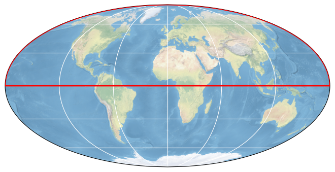
Bounding box map#
Map tiles and data from OpenStreetMap, under the ODbL.
Basic information#
| Parameter | Value |
|---|---|
| Bounding box longitude (°) | -180 to 180 |
| Bounding box latitude (°) | 0 to 90 |
| Time range | 2000-01-01 to 2020-01-01 |
Click here for full dataset metadata.
Variable list#
Click on a variable name to jump to the variable’s full metadata.
| Variable | Long name | Units |
|---|---|---|
| GST | GST surface temperature | degrees celsius |
| T10m | T10m solid earth subsurface temperature | degrees celsius |
| T1m | T1m solid earth subsurface temperature | degrees celsius |
| T2m | T2m solid earth subsurface temperature | degrees celsius |
| T5m | T5m solid earth subsurface temperature | degrees celsius |
| polar_stereographic | [none] | [none] |
Full variable metadata#
GST#
| Field | Value |
|---|---|
| color_bar_name | coolwarm |
| color_value_max | 30 |
| color_value_min | -30 |
| grid_mapping | polar_stereographic |
| long_name | GST surface temperature |
| orig_data_type | uint16 |
| standard_name | surface_temperature |
| units | degrees celsius |
| valid_max | 100 |
| valid_min | -100 |
T10m#
| Field | Value |
|---|---|
| color_bar_name | coolwarm |
| color_value_max | 30 |
| color_value_min | -30 |
| grid_mapping | polar_stereographic |
| long_name | T10m solid earth subsurface temperature |
| orig_data_type | uint16 |
| standard_name | solid_earth_subsurface_temperature |
| units | degrees celsius |
| valid_max | 100 |
| valid_min | -100 |
T1m#
| Field | Value |
|---|---|
| color_bar_name | coolwarm |
| color_value_max | 30 |
| color_value_min | -30 |
| grid_mapping | polar_stereographic |
| long_name | T1m solid earth subsurface temperature |
| orig_data_type | uint16 |
| standard_name | solid_earth_subsurface_temperature |
| units | degrees celsius |
| valid_max | 100 |
| valid_min | -100 |
T2m#
| Field | Value |
|---|---|
| color_bar_name | coolwarm |
| color_value_max | 30 |
| color_value_min | -30 |
| grid_mapping | polar_stereographic |
| long_name | T2m solid earth subsurface temperature |
| orig_data_type | uint16 |
| standard_name | solid_earth_subsurface_temperature |
| units | degrees celsius |
| valid_max | 100 |
| valid_min | -100 |
T5m#
| Field | Value |
|---|---|
| color_bar_name | coolwarm |
| color_value_max | 30 |
| color_value_min | -30 |
| grid_mapping | polar_stereographic |
| long_name | T5m solid earth subsurface temperature |
| orig_data_type | uint16 |
| standard_name | solid_earth_subsurface_temperature |
| units | degrees celsius |
| valid_max | 100 |
| valid_min | -100 |
polar_stereographic#
| Field | Value |
|---|---|
| GeoTransform | -8679599.425969256 926.6254331383326 0 4120958.560533902 0 -926.6254331383326 |
| chunk_sizes | |
| crs_wkt | PROJCRS["WGS 84 / Arctic Polar Stereographic",BASEGEOGCRS["WGS 84",ENSEMBLE["World Geodetic System 1984 ensemble",MEMBER["World Geodetic System 1984 (Transit)"],MEMBER["World Geodetic System 1984 (G730)"],MEMBER["World Geodetic System 1984 (G873)"],MEMBER["World Geodetic System 1984 (G1150)"],MEMBER["World Geodetic System 1984 (G1674)"],MEMBER["World Geodetic System 1984 (G1762)"],MEMBER["World Geodetic System 1984 (G2139)"],ELLIPSOID["WGS 84",6378137,298.257223563,LENGTHUNIT["metre",1]],ENSEMBLEACCURACY[2.0]],PRIMEM["Greenwich",0,ANGLEUNIT["degree",0.0174532925199433]],ID["EPSG",4326]],CONVERSION["Arctic Polar Stereographic",METHOD["Polar Stereographic (variant B)",ID["EPSG",9829]],PARAMETER["Latitude of standard parallel",71,ANGLEUNIT["degree",0.0174532925199433],ID["EPSG",8832]],PARAMETER["Longitude of origin",0,ANGLEUNIT["degree",0.0174532925199433],ID["EPSG",8833]],PARAMETER["False easting",0,LENGTHUNIT["metre",1],ID["EPSG",8806]],PARAMETER["False northing",0,LENGTHUNIT["metre",1],ID["EPSG",8807]]],CS[Cartesian,2],AXIS["easting (X)",south,MERIDIAN[90,ANGLEUNIT["degree",0.0174532925199433]],ORDER[1],LENGTHUNIT["metre",1]],AXIS["northing (Y)",south,MERIDIAN[180,ANGLEUNIT["degree",0.0174532925199433]],ORDER[2],LENGTHUNIT["metre",1]],USAGE[SCOPE["Polar research."],AREA["Northern hemisphere - north of 60°N onshore and offshore, including Arctic."],BBOX[60,-180,90,180]],ID["EPSG",3995]] |
| data_type | int64 |
| dimensions | |
| esri_wkt | PROJCS[\"WGS_84_Arctic_Polar_Stereographic\",GEOGCS[\"GCS_WGS_1984\",DATUM[\"D_WGS_1984\",SPHEROID[\"WGS_1984\",6378137,298.257223563]],PRIMEM[\"Greenwich\",0],UNIT[\"Degree\",0.017453292519943295]],PROJECTION[\"Stereographic_North_Pole\"],PARAMETER[\"standard_parallel_1\",71],PARAMETER[\"central_meridian\",0],PARAMETER[\"false_easting\",0],PARAMETER[\"false_northing\",0],UNIT[\"Meter\",1]] |
| false_easting | 0.0 |
| false_northing | 0.0 |
| file_chunk_sizes | 1 |
| file_dimensions | |
| fill_value | 9223372036854775807 |
| geographic_crs_name | WGS 84 |
| grid_mapping_name | polar_stereographic |
| horizontal_datum_name | World Geodetic System 1984 ensemble |
| inverse_flattening | 298.257223563 |
| latitude_of_projection_origin | 90.0 |
| longitude_of_prime_meridian | 0.0 |
| orig_data_type | int32 |
| prime_meridian_name | Greenwich |
| projected_crs_name | WGS 84 / Arctic Polar Stereographic |
| reference_ellipsoid_name | WGS 84 |
| semi_major_axis | 6378137.0 |
| semi_minor_axis | 6356752.314245179 |
| shape | |
| size | 1 |
| spatial_ref | GEOGCS[\"WGS 84\",DATUM[\"WGS_1984\",SPHEROID[\"WGS 84\",6378137,298.257223563,AUTHORITY[\"EPSG\",\"7030\"]],AUTHORITY[\"EPSG\",\"6326\"]],PRIMEM[\"Greenwich\",0],UNIT[\"degree\",0.0174532925199433],AUTHORITY[\"EPSG\",\"4326\"]],PROJECTION[\"Polar_Stereographic\"],PARAMETER[\"latitude_of_origin\",45],PARAMETER[\"central_meridian\",-170],PARAMETER[\"scale_factor\",1],PARAMETER[\"false_easting\",0],PARAMETER[\"false_northing\",0],UNIT[\"metre\",1,AUTHORITY[\"EPSG\",\"9001\"]] |
| standard_parallel | 71.0 |
| straight_vertical_longitude_from_pole | 0.0 |
Full dataset metadata#
| Field | Value |
|---|---|
| Conventions | CF-1.7 |
| date_created | 2023-05-08 |
| history | cube_params: time_range: 2019-01-01T00:00:00, 2019-12-31T00:00:00, variable_names: polar_stereographic, GST, T1m, T2m, T5m, T10m, program: xcube_cci.chunkstore.CciChunkStore |
| id | esa-cci-permafrost-1x1151x1641-0.0.2 |
| processing_level | L4 |
| project | DeepESDL |
| source | esacci.PERMAFROST.yr.L4.GTD.multi-sensor.multi-platform.ERA5_MODISLST_BIASCORRECTED.03-0.r1, esacci.PERMAFROST.yr.L4.GTD.multi-sensor.multi-platform.MODISLST_CRYOGRID.03-0.r1 |
| time_coverage_duration | P365DT0H0M0S |
| time_coverage_end | 2019-07-02T12:00:00 |
| time_coverage_start | 2000-07-02T12:00:00 |
| title | ESA CCI PERMAFROST |