Black Sea Data Cube#
How to open this dataset in DeepESDL JupyterLab#
from xcube.core.store import new_data_store
store = new_data_store("s3", root="deep-esdl-public", storage_options=dict(anon=True))
# The cube is saved as a multilevel cube, the level 0 is the base layer with
# the highest resolution
ml_dataset = store.open_data('black-sea-1x1024x1024.levels')
# Chek how many levels are present
ml_dataset.num_levels
# Open dataset at a certain level, here level 0
ds = ml_dataset.get_dataset(0)
Bounding box map#
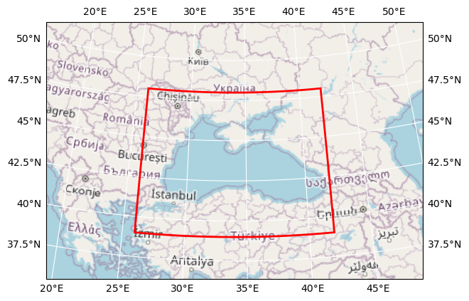
Map tiles and data from OpenStreetMap, under the ODbL.
Basic information#
| Parameter | Value |
|---|---|
| Bounding box longitude (°) | 26.0 to 41.998999999999725 |
| Bounding box latitude (°) | 39.000000000000156 to 48.0 |
| Time range | 2015-12-31 to 2017-12-31 |
| Time period | 1D |
| Publisher | Brockmann Consult GmbH |
Click here for full dataset metadata.
Variable list#
Click on a variable name to jump to the variable’s full metadata.
| Variable | Long name | Units |
|---|---|---|
| VHM0 | Spectral Significant Wave Height (Hm0) | m |
| chl | Chlorophyll Concentration | mg m^-3 |
| sla | Sea Level Anomaly | m |
| sss | Sea Surface Salinity | psu |
| sst | Sea Surface Temperature | K |
| ugos | Absolute Geostrophic Velocity: Zonal Component | m s^-1 |
| ugosa | Geostrophic Velocity Anomalies: Zonal Component | m s^-1 |
| vgos | Absolute Geostrophic Velocity: Meridian Component | m s^-1 |
| vgosa | Geostrophic Velocity Anomalies: Meridian Component | m s^-1 |
Full variable metadata#
VHM0#
| Field | Value |
|---|---|
| grid_mapping | crs |
| long_name | Spectral Significant Wave Height (Hm0) |
| processing_level | L4 |
| references | https://resources.marine.copernicus.eu/product-detail/BLKSEA_MULTIYEAR_WAV_007_006/DOCUMENTATION |
| source | CMEMS, Black Sea Waves Reanalysis |
| standard_name | sea_surface_wave_significant_height |
| units | m |
| valid_max | 6.0 |
| valid_min | 0.0 |
chl#
| Field | Value |
|---|---|
| grid_mapping | crs |
| long_name | Chlorophyll Concentration |
| processing_level | L3 |
| references | http://www.eo4sibs.uliege.be/doc/EO4SIBS_DUM_ATBD_OceanColour.pdf |
| source | EO4SIBS, Level 3 Chl-a, 300m, daily and monthly |
| standard_name | chlorophyll_concentration |
| units | mg m^-3 |
| valid_max | 31.0 |
| valid_min | 0.0 |
crs#
| Field | Value |
|---|---|
| crs_wkt | GEOGCS["WGS 84",DATUM["WGS_1984",SPHEROID["WGS 84",6378137,298.257223563,AUTHORITY["EPSG","7030"]],AUTHORITY["EPSG","6326"]],PRIMEM["Greenwich",0,AUTHORITY["EPSG","8901"]],UNIT["degree",0.0174532925199433,AUTHORITY["EPSG","9122"]],AXIS["Latitude",NORTH],AXIS["Longitude",EAST],AUTHORITY["EPSG","4326"]] |
| geographic_crs_name | WGS 84 |
| grid_mapping_name | latitude_longitude |
| inverse_flattening | 298.257223563 |
| longitude_of_prime_meridian | 0.0 |
| prime_meridian_name | Greenwich |
| reference_ellipsoid_name | WGS 84 |
| semi_major_axis | 6378137.0 |
| semi_minor_axis | 6356752.314245179 |
sla#
| Field | Value |
|---|---|
| grid_mapping | crs |
| long_name | Sea Level Anomaly |
| processing_level | L4 |
| references | http://www.eo4sibs.uliege.be/doc/EO4SIBS_D4.4_AltimetryL4_DUM_v1.1.pdf |
| source | EO4SIBS, Level 4, geostrophic currents, multi-mission gridded merged products for a period of 1 year, 0.0625°*0.0625°, daily |
| standard_name | sea_surface_height_above_sea_level |
| units | m |
| valid_max | 0.5 |
| valid_min | -0.5 |
sss#
| Field | Value |
|---|---|
| grid_mapping | crs |
| long_name | Sea Surface Salinity |
| processing_level | L3 |
| references | http://www.eo4sibs.uliege.be/doc/EO4SIBS_DUM_ATBD_Salinity.pdf |
| source | EO4SIBS, Level 3 SSS, 0.25°*0.25°, 9-day averaged produced daily |
| standard_name | sea_surface_salinity |
| units | psu |
| valid_max | 29.0 |
| valid_min | 1.0 |
sst#
| Field | Value |
|---|---|
| grid_mapping | crs |
| long_name | Sea Surface Temperature |
| processing_level | L3 |
| references | https://resources.marine.copernicus.eu/product-detail/SST_BS_SST_L3S_NRT_OBSERVATIONS_010_013/DOCUMENTATION |
| source | CMEMS, Black Sea - High Resolution and Ultra High Resolution L3S Sea Surface Temperature |
| standard_name | sea_surface_temperature |
| units | K |
| valid_max | 305.0 |
| valid_min | 270.0 |
ugos#
| Field | Value |
|---|---|
| grid_mapping | crs |
| long_name | Absolute Geostrophic Velocity: Zonal Component |
| processing_level | L4 |
| references | http://www.eo4sibs.uliege.be/doc/EO4SIBS_D4.4_AltimetryL4_DUM_v1.1.pdf |
| source | EO4SIBS, Level 4, geostrophic currents, multi-mission gridded merged products for a period of 1 year, 0.0625°*0.0625°, daily |
| standard_name | surface_geostrophic_eastward_sea_water_velocity |
| units | m s^-1 |
| valid_max | 2.0 |
| valid_min | -2.0 |
ugosa#
| Field | Value |
|---|---|
| grid_mapping | crs |
| long_name | Geostrophic Velocity Anomalies: Zonal Component |
| processing_level | L4 |
| references | http://www.eo4sibs.uliege.be/doc/EO4SIBS_D4.4_AltimetryL4_DUM_v1.1.pdf |
| source | EO4SIBS, Level 4, geostrophic currents, multi-mission gridded merged products for a period of 1 year, 0.0625°*0.0625°, daily |
| standard_name | surface_geostrophic_eastward_sea_water_velocity_assuming_sea_level_for_geoid |
| units | m s^-1 |
| valid_max | 2.0 |
| valid_min | -2.0 |
vgos#
| Field | Value |
|---|---|
| grid_mapping | crs |
| long_name | Absolute Geostrophic Velocity: Meridian Component |
| processing_level | L4 |
| references | http://www.eo4sibs.uliege.be/doc/EO4SIBS_D4.4_AltimetryL4_DUM_v1.1.pdf |
| source | EO4SIBS, Level 4, geostrophic currents, multi-mission gridded merged products for a period of 1 year, 0.0625°*0.0625°, daily |
| standard_name | surface_geostrophic_northward_sea_water_velocity |
| units | m s^-1 |
| valid_max | 2.0 |
| valid_min | -2.0 |
vgosa#
| Field | Value |
|---|---|
| grid_mapping | crs |
| long_name | Geostrophic Velocity Anomalies: Meridian Component |
| processing_level | L4 |
| references | http://www.eo4sibs.uliege.be/doc/EO4SIBS_D4.4_AltimetryL4_DUM_v1.1.pdf |
| source | EO4SIBS, Level 4, geostrophic currents, multi-mission gridded merged products for a period of 1 year, 0.0625°*0.0625°, daily |
| standard_name | surface_geostrophic_northward_sea_water_velocity_assuming_sea_level_for_geoid |
| units | m s^-1 |
| valid_max | 2.0 |
| valid_min | -2.0 |
Full dataset metadata#
| Field | Value |
|---|---|
| Conventions | CF-1.9 |
| acknowledgment | EO4SIBS, CMEMS, DeepESDL project |
| contributor_name | Brockmann Geomatics Sweden AB |
| contributor_url | www.brockmann-geomatics.se |
| creator_email | info@brockmann-consult.de |
| creator_name | Brockmann Consult GmbH |
| creator_url | www.brockmann-consult.de |
| date_modified | 2022-08-19 16:19:15.359970 |
| geospatial_lat_max | 47.9985 |
| geospatial_lat_min | 39.001500000000156 |
| geospatial_lat_resolution | 0.0030000000000001137 |
| geospatial_lon_max | 41.997499999999725 |
| geospatial_lon_min | 26.0015 |
| geospatial_lon_resolution | 0.0030000000000001137 |
| id | black-sea-256x256x256 |
| institution | Brockmann Consult GmbH |
| license | Terms and conditions of the DeepESDL data distribution |
| project | DeepESDL |
| publisher_email | info@brockmann-consult.de |
| publisher_name | Brockmann Consult GmbH |
| publisher_url | www.brockmann-consult.de |
| source | EO4SIBS, CMEMS |
| time_coverage_end | 2017-12-31T00:00:00.000000000 |
| time_coverage_start | 2016-01-01T00:00:00.000000000 |
| title | Black Sea Data Cube |