Land Cover Map of ESA CCI brokered by CDS#
How to open this dataset in DeepESDL JupyterLab#
from xcube.core.store import new_data_store
store = new_data_store("s3", root="deep-esdl-public", storage_options=dict(anon=True))
# The cube is saved as a multilevel cube, the level 0 is the base layer with
# the highest resolution
ml_dataset = store.open_data('LC-1x2160x2160-1.0.0.levels')
# Chek how many levels are present
ml_dataset.num_levels
# Open dataset at a certain level, here level 0
ds = ml_dataset.get_dataset(0)
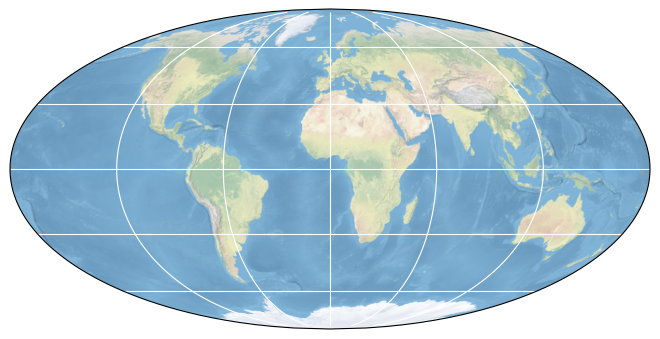
Bounding box map#
Map tiles and data from OpenStreetMap, under the ODbL.
Basic information#
| Parameter | Value |
|---|---|
| Bounding box longitude (°) | -180.0 to 180.00000000000003 |
| Bounding box latitude (°) | -90.0 to 90.00000000000001 |
| Time range | 2010-01-01 to 2020-12-31 |
Click here for full dataset metadata.
Variable list#
Click on a variable name to jump to the variable’s full metadata.
| Variable | Long name | Units |
|---|---|---|
| change_count | number of class changes | [none] |
| current_pixel_state | LC pixel type mask | [none] |
| lat_bounds | [none] | [none] |
| lccs_class | Land cover class defined in LCCS | [none] |
| lon_bounds | [none] | [none] |
| observation_count | number of valid observations | [none] |
| processed_flag | LC map processed area flag | [none] |
| time_bounds | [none] | [none] |
Full variable metadata#
change_count#
| Field | Value |
|---|---|
| long_name | number of class changes |
| valid_max | 100 |
| valid_min | 0 |
crs#
| Field | Value |
|---|---|
| i2m | 0.002777777777778,0.0,0.0,-0.002777777777778,-180.0,90.0 |
| wkt | GEOGCS["WGS 84", DATUM["World Geodetic System 1984", SPHEROID["WGS 84", 6378137.0, 298.257223563, AUTHORITY["EPSG","7030"]], AUTHORITY["EPSG","6326"]], PRIMEM["Greenwich", 0.0, AUTHORITY["EPSG","8901"]], UNIT["degree", 0.017453292519943295], AXIS["Geodetic longitude", EAST], AXIS["Geodetic latitude", NORTH], AUTHORITY["EPSG","4326"]] |
current_pixel_state#
| Field | Value |
|---|---|
| flag_meanings | invalid clear_land clear_water clear_snow_ice cloud cloud_shadow |
| flag_values | 0, 1, 2, 3, 4, 5 |
| long_name | LC pixel type mask |
| standard_name | land_cover_lccs status_flag |
| valid_max | 5 |
| valid_min | 0 |
lat_bounds#
lccs_class#
| Field | Value |
|---|---|
| ancillary_variables | processed_flag current_pixel_state observation_count change_count |
| flag_colors | #ffff64 #ffff64 #ffff00 #aaf0f0 #dcf064 #c8c864 #006400 #00a000 #00a000 #aac800 #003c00 #003c00 #005000 #285000 #285000 #286400 #788200 #8ca000 #be9600 #966400 #966400 #966400 #ffb432 #ffdcd2 #ffebaf #ffc864 #ffd278 #ffebaf #00785a #009678 #00dc82 #c31400 #fff5d7 #dcdcdc #fff5d7 #0046c8 #ffffff |
| flag_meanings | no_data cropland_rainfed cropland_rainfed_herbaceous_cover cropland_rainfed_tree_or_shrub_cover cropland_irrigated mosaic_cropland mosaic_natural_vegetation tree_broadleaved_evergreen_closed_to_open tree_broadleaved_deciduous_closed_to_open tree_broadleaved_deciduous_closed tree_broadleaved_deciduous_open tree_needleleaved_evergreen_closed_to_open tree_needleleaved_evergreen_closed tree_needleleaved_evergreen_open tree_needleleaved_deciduous_closed_to_open tree_needleleaved_deciduous_closed tree_needleleaved_deciduous_open tree_mixed mosaic_tree_and_shrub mosaic_herbaceous shrubland shrubland_evergreen shrubland_deciduous grassland lichens_and_mosses sparse_vegetation sparse_tree sparse_shrub sparse_herbaceous tree_cover_flooded_fresh_or_brakish_water tree_cover_flooded_saline_water shrub_or_herbaceous_cover_flooded urban bare_areas bare_areas_consolidated bare_areas_unconsolidated water snow_and_ice |
| flag_values | 0, 10, 11, 12, 20, 30, 40, 50, 60, 61, 62, 70, 71, 72, 80, 81, 82, 90, 100, 110, 120, 121, 122, 130, 140, 150, 151, 152, 153, 160, 170, 180, 190, 200, 201, 202, 210, 220 |
| long_name | Land cover class defined in LCCS |
| standard_name | land_cover_lccs |
| valid_max | 220 |
| valid_min | 1 |
lon_bounds#
observation_count#
| Field | Value |
|---|---|
| long_name | number of valid observations |
| standard_name | land_cover_lccs number_of_observations |
| valid_max | 32767 |
| valid_min | 0 |
processed_flag#
| Field | Value |
|---|---|
| flag_meanings | not_processed processed |
| flag_values | 0, 1 |
| long_name | LC map processed area flag |
| standard_name | land_cover_lccs status_flag |
| valid_max | 1 |
| valid_min | 0 |
time_bounds#
Full dataset metadata#
| Field | Value |
|---|---|
| Conventions | CF-1.6 |
| TileSize | 2025:2025 |
| cdm_data_type | grid |
| comment | |
| contact | https://www.ecmwf.int/en/about/contact-us/get-support |
| creation_date | 20181130T095431Z |
| creator_email | landcover-cci@uclouvain.be |
| creator_name | UCLouvain |
| creator_url | http://www.uclouvain.be/ |
| geospatial_lat_max | 90.0 |
| geospatial_lat_min | -90.0 |
| geospatial_lat_resolution | 0.002778 |
| geospatial_lat_units | degrees_north |
| geospatial_lon_max | 180 |
| geospatial_lon_min | -180 |
| geospatial_lon_resolution | 0.002778 |
| geospatial_lon_units | degrees_east |
| history | amorgos-4,0, lc-sdr-1.0, lc-sr-1.0, lc-classification-1.0,lc-user-tools-3.13,lc-user-tools-4.3 |
| id | ESACCI-LC-L4-LCCS-Map-300m-P1Y-2010-v2.0.7cds |
| institution | UCLouvain |
| keywords | land cover classification,satellite,observation |
| keywords_vocabulary | NASA Global Change Master Directory (GCMD) Science Keywords |
| license | ESA CCI Data Policy: free and open access |
| naming_authority | org.esa-cci |
| product_version | 2.0.7cds |
| project | Climate Change Initiative - European Space Agency |
| references | http://www.esa-landcover-cci.org/ |
| source | MERIS FR L1B version 5.05, MERIS RR L1B version 8.0, SPOT VGT P |
| spatial_resolution | 300m |
| standard_name_vocabulary | NetCDF Climate and Forecast (CF) Standard Names version 21 |
| summary | This dataset characterizes the land cover of a particular year (see time_coverage). The land cover was derived from the analysis of satellite data time series of the full period. |
| time_coverage_duration | P1Y |
| time_coverage_end | 20101231 |
| time_coverage_resolution | P1Y |
| time_coverage_start | 20100101 |
| title | Land Cover Map of ESA CCI brokered by CDS |
| tracking_id | 96ac9aca-1ca7-45c6-b4a5-ab448c692646 |
| type | ESACCI-LC-L4-LCCS-Map-300m-P1Y |